Kuwait Energy
EL-12-211107
89
The general tectonic history of this area is defined by rifting of the major plates from
Gondwana during the Jurassic/Early Cretaceous through the beginning of the Tertiary.
The structural style is predominantly extensional. The major faulting is in a north-south
direction with limited displacements. This north-south faulting generates alternating
horsts and grabens, leading to potential fault-bounded structural traps. Possible
stratigraphic traps within the Lower Goru and Sembar formations are another play, but
these will require further study and better quality seismic data to define.
The Sembar Formation is the primary source rock (Type II/III kerogen) in the Basin and is
expected to be present within the Jherruck Block. Based on burial history studies, the
Sembar Formation reached the gas generation window by the late Cretaceous. There
may also be other sources for the liquid hydrocarbons found in the Basin.
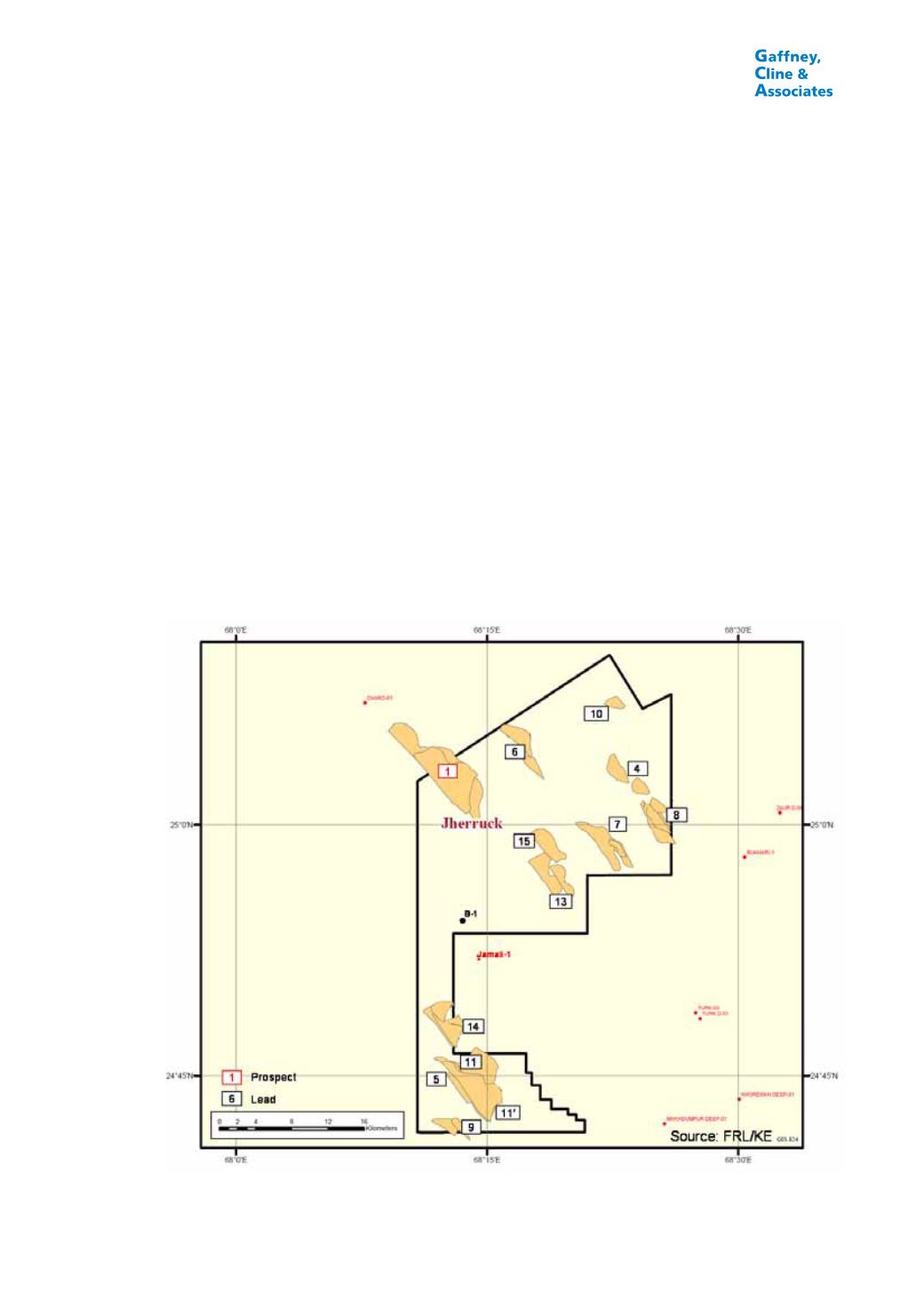
The Jherruck Block is covered by 1,341 km of 2D seismic lines obtained in 14 surveys
conducted from the 1970s to 2008. The seismic data quality is poor to locally fair for
structural interpretation, with the more recently acquired lines being of noticeably better
quality. One Prospect has been identified within the Lower Goru Formation (Figure 6.6
and Table 6.12), with three separate target horizons at depths of 7,500-10,500 ft (2,300-
3,200 m). Fourteen Leads have also been defined (Figure 6.6 and Table 6.13), some
with multiple target horizons, in the Lower Goru, Sembar and Chiltan Formations.
FIGURE 6.6
PROSPECTS AND LEADS, JHERRUCK BLOCK, PAKISTAN


