Kuwait Energy
EL-12-211107
43
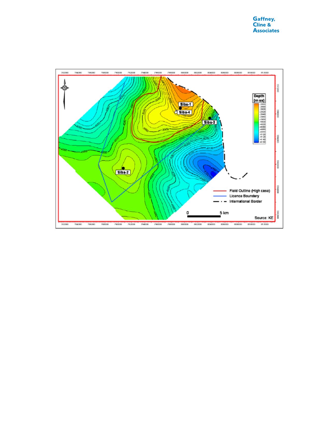
FIGURE 3.3
TOP YAMAMA DEPTH MAP, SIBA FIELD, IRAQ
Notes:
1.
This is the map supplied by the Ministry of Oil; to estimate GIIP, alternative maps have been
generated by KE using various different time to depth conversion algorithms.
2.
The field outline shown is approximate: KE has estimated a separate field outline for each reservoir
and for each case (low, best and high).
A second well, Siba-2, was drilled in 1974, some 12.9 km southwest of Siba-1 on the
flank of the structure. In cased hole production tests of the Yamama A, C, D, E and F, no
flow to surface was obtained; a small amount of 38°API oil (about 120 Bbl) was recovered
from the Yamama F. A third well, Siba-3, was drilled in 1992, to the south-east of Siba-1,
but failed to recover any hydrocarbons in tests of the Yamama A and C before being
plugged and abandoned.
In 1993, the Siba-1 well was re-entered and the Yamama C and D Formations re-tested
following acidization. The maximum gas production rate achieved was 16.95 MMscfd
with 2,650 bpd of condensate. In early 2013, KE worked over this well and achieved
production rates of up to 22 MMscfd gas and 3,700 bpd condensate.
Average condensate to gas ratio (CGR) in the well tests is about 160 Bbl/MMscf. The
gas contains about 3% CO
2
and 500 ppm H
2
S. The initial reservoir pressure is about
8,200 psia, which means that the reservoir is over-pressured.
The Siba field is covered by a number of seismic lines acquired in 1973 and 1993, with a
line spacing of approximately 2 km by 5 km. The overall seismic data quality is poor to
fair for structural mapping and poor for stratigraphic, lithologic and fluid interpretation. It
appears that the field may extend into Iran, but no data are available to confirm this. GCA


